Sustainable Ocean Health and Blue Carbon Solutions
PTTEP strives to enhance the operational efficiency and specialization of offshore assets in the Gulf of Thailand, under the goal to become a marine and coastal data center that links up with domestic and foreign government offices and private organizations. The center also aims to broaden data access to people in general who share the ambition in protecting and preserving marine resources as well as researchers.
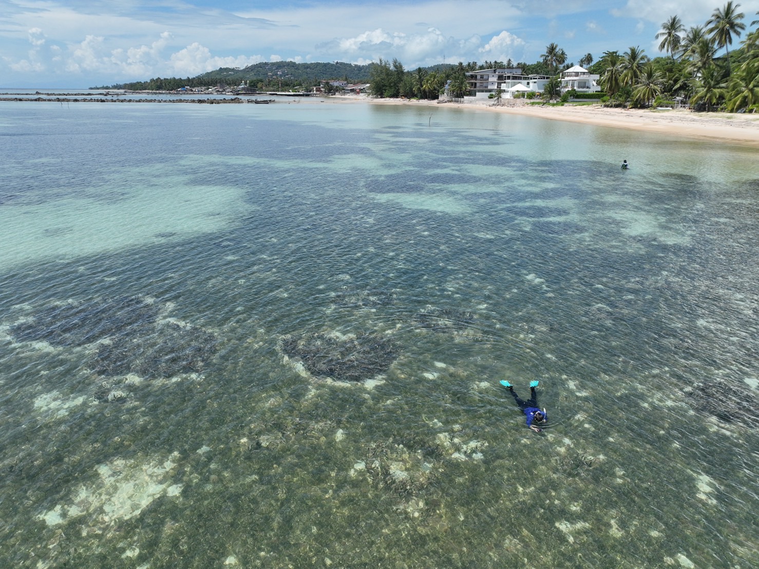
Feasibility studies for carbon dioxide absorption by the ocean and coastal ecosystems, also known as “blue carbon” (e.g., seagrass, seaweed, seashell) aim to support achieving the PTTEP’s goal of net zero greenhouse gas emissions by 2050 or “EP Net Zero 2050”. The Company believes that the biodiversity abundance and ecosystems improvement lead to availability of robust carbon sinks.
The project encompasses a joint study with Kasetsart University regarding techniques for expanding seagrass areas and potential areas to grow seagrass, and a joint study with Chulalongkorn University regarding research on seaweed and seashell species that have the ability to store carbon and grow well in the Gulf of Thailand. The results of the studies will help with a concrete conservation planning for Thailand’s sea as well as enhancing biodiversity abundance and the efficiency of carbon sinks. This, in turn, will lead to an increase in the amount of carbon dioxide absorption.
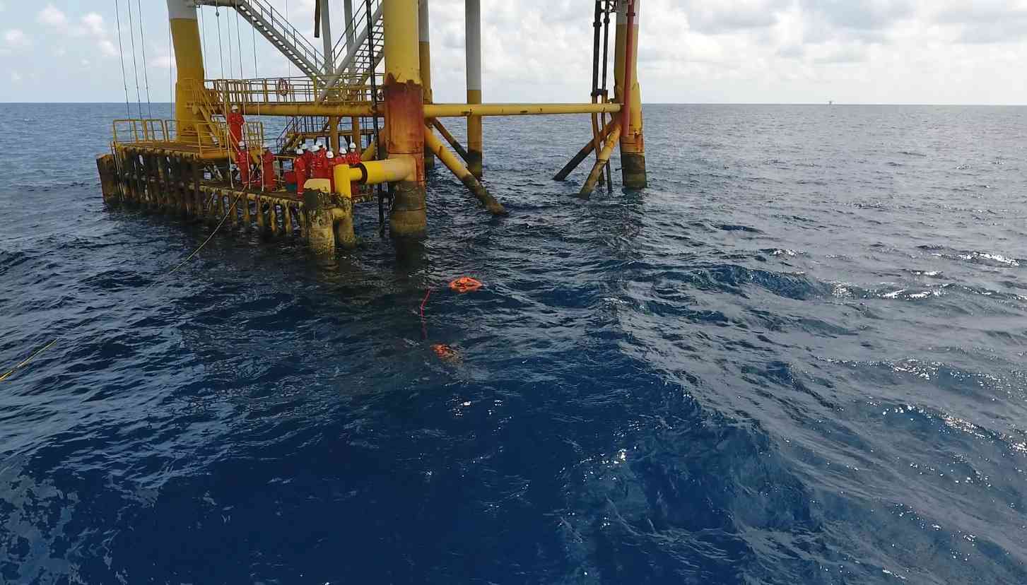
The project of “Development of ocean current mapping and seawater surface temperature study through the use of current mapper buoys and satellite tracking” aims to conduct scientific study of the ocean covering temperature and currents at the seawater surface through the use of current mapper buoys equipped with temperature sensor with location tracking by satellite technology. This project has been initiated under the collaboration between PTTEP, the Hydro-Informatics Institute (HII) and Kasetsart University. Results of the study shall be used as the key inputs for various ocean conservation and emergency plans and early warning system as well as the enhancement of ocean mathematical models.
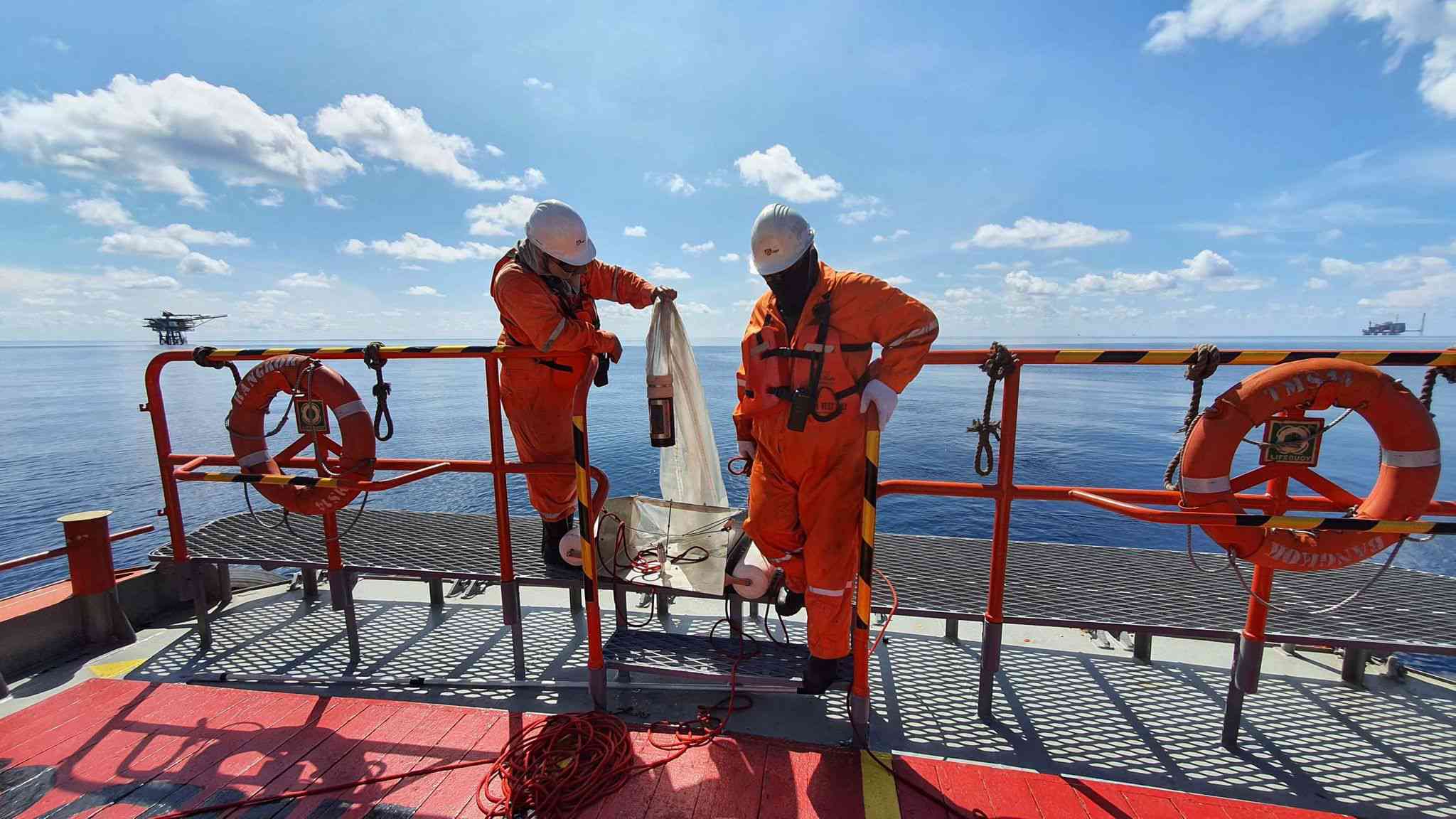
PTTEP has utilized its offshore operational sites to create microplastic baseline data and its quantity monitoring. This includes analyzing microplastic volumes, identifying plastic types, and determining the specific plastic products detected. In collaboration with Kasetsart University to promote ocean sustainability, the project began collecting microplastic samples in seawater in the Gulf of Thailand in 2020, which is the first time in Thailand and also the world’s first attempt to use an offshore petroleum platform as a sampling location. The project results will benefit ocean scientists and various government agencies in evaluating marine debris challenges and leading to concrete conservation of marine resources.
Global warming and rising seawater temperature have significant impacts on coral reefs, also known as “coral bleaching” and direct impacts on biodiversity. In 2021, PTTEP, in collaboration with Kasetsart University has launched the “coral bleaching and biodiversity monitoring in coral reef areas using drone’s multispectral imaging application” project, with the expertise provided by AI and Robotics Ventures Company Limited (ARV). This is the first time in Southeast Asia to implement such project and as an advanced innovation compared to the existing traditional field survey techniques, in the areas of Koh Man Nai and Hin Tuoy Hoi in Rayong province. The project aims to gather data and ecosystem mapping development to track changes in coral bleaching. In the future, the application of multispectral imaging from drones will be developed more intensively to improve the survey and analysis of changes in biodiversity to be more rapid and efficient.
Conservation of iconic aquatic animals to increase their population and survival rate is vital in both Thailand and the global agenda. Considering the importance of this critical issue, PTTEP has launched a project of underwater camera installation and Artificial Intelligence (AI) software application for the identification of iconic aquatic animals from the recorded video files. Currently, there are underwater cameras installed on the jacket legs of two offshore petroleum platforms to monitor aquatic animals and to obtain the biodiversity baseline information. Besides, PTTEP plans to extend the use of this AI software in other marine areas through collaboration with other organizations.
Feasibility studies for carbon dioxide absorption by blue carbon (seagrass, seaweed and seashell)
Feasibility studies for carbon dioxide absorption by the ocean and coastal ecosystems, also known as “blue carbon” (e.g., seagrass, seaweed, seashell) aim to support achieving the PTTEP’s goal of net zero greenhouse gas emissions by 2050 or “EP Net Zero 2050”. The Company believes that the biodiversity abundance and ecosystems improvement lead to availability of robust carbon sinks.
The project encompasses a joint study with Kasetsart University regarding techniques for expanding seagrass areas and potential areas to grow seagrass, and a joint study with Chulalongkorn University regarding research on seaweed and seashell species that have the ability to store carbon and grow well in the Gulf of Thailand. The results of the studies will help with a concrete conservation planning for Thailand’s sea as well as enhancing biodiversity abundance and the efficiency of carbon sinks. This, in turn, will lead to an increase in the amount of carbon dioxide absorption.
Development of ocean current mapping and seawater surface temperature study through the use of current mapper buoys and satellite tracking
The project of “Development of ocean current mapping and seawater surface temperature study through the use of current mapper buoys and satellite tracking” aims to conduct scientific study of the ocean covering temperature and currents at the seawater surface through the use of current mapper buoys equipped with temperature sensor with location tracking by satellite technology. This project has been initiated under the collaboration between PTTEP, the Hydro-Informatics Institute (HII) and Kasetsart University. Results of the study shall be used as the key inputs for various ocean conservation and emergency plans and early warning system as well as the enhancement of ocean mathematical models.
Microplastic baseline and offshore monitoring in the Gulf of Thailand
PTTEP has utilized its offshore operational sites to create microplastic baseline data and its quantity monitoring. This includes analyzing microplastic volumes, identifying plastic types, and determining the specific plastic products detected. In collaboration with Kasetsart University to promote ocean sustainability, the project began collecting microplastic samples in seawater in the Gulf of Thailand in 2020, which is the first time in Thailand and also the world’s first attempt to use an offshore petroleum platform as a sampling location. The project results will benefit ocean scientists and various government agencies in evaluating marine debris challenges and leading to concrete conservation of marine resources.
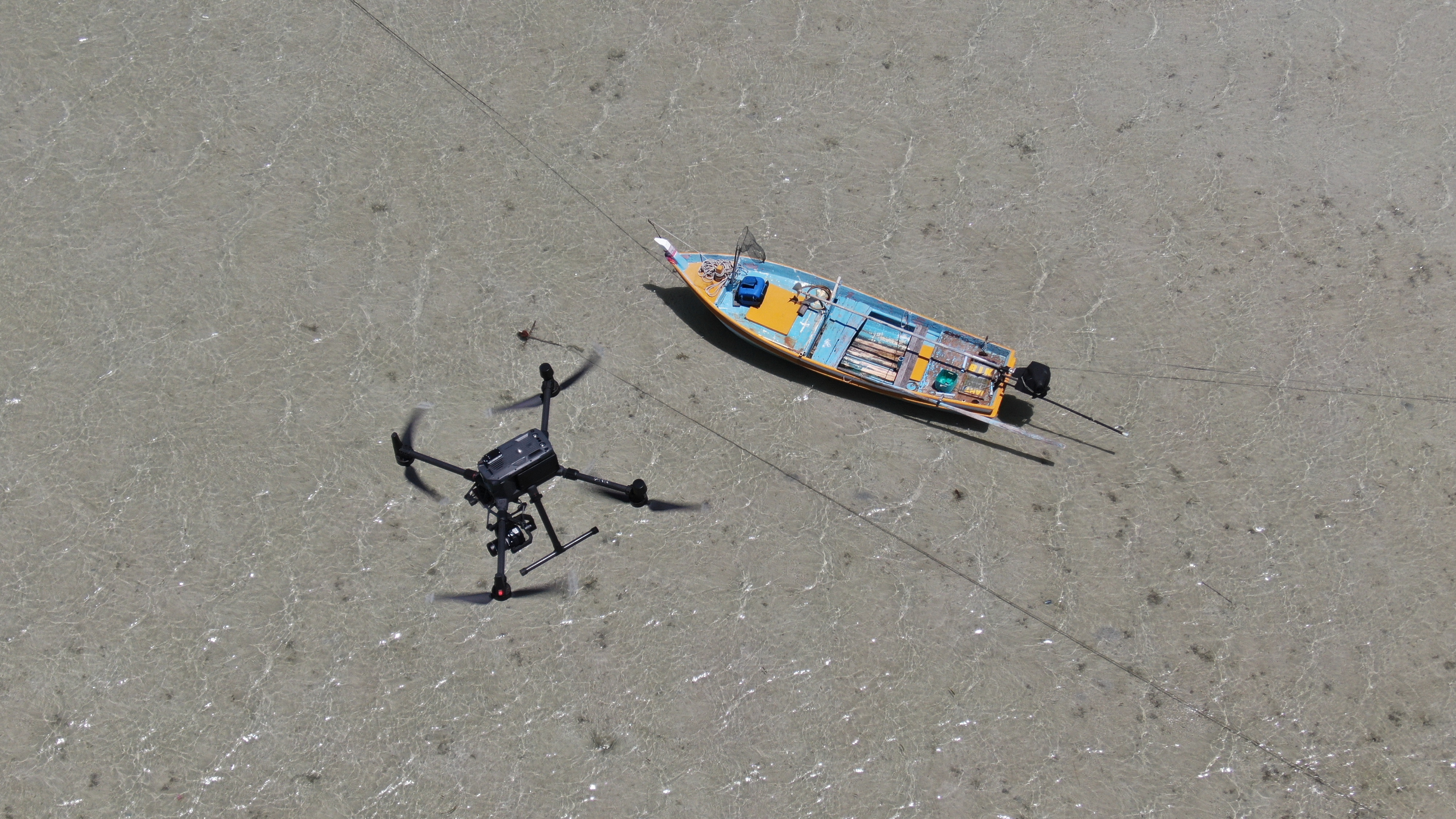
Coral bleaching and biodiversity monitoring in coral reef areas using drone’s multispectral imaging application
Global warming and rising seawater temperature have significant impacts on coral reefs, also known as “coral bleaching” and direct impacts on biodiversity. In 2021, PTTEP, in collaboration with Kasetsart University has launched the “coral bleaching and biodiversity monitoring in coral reef areas using drone’s multispectral imaging application” project, with the expertise provided by AI and Robotics Ventures Company Limited (ARV). This is the first time in Southeast Asia to implement such project and as an advanced innovation compared to the existing traditional field survey techniques, in the areas of Koh Man Nai and Hin Tuoy Hoi in Rayong province. The project aims to gather data and ecosystem mapping development to track changes in coral bleaching. In the future, the application of multispectral imaging from drones will be developed more intensively to improve the survey and analysis of changes in biodiversity to be more rapid and efficient.
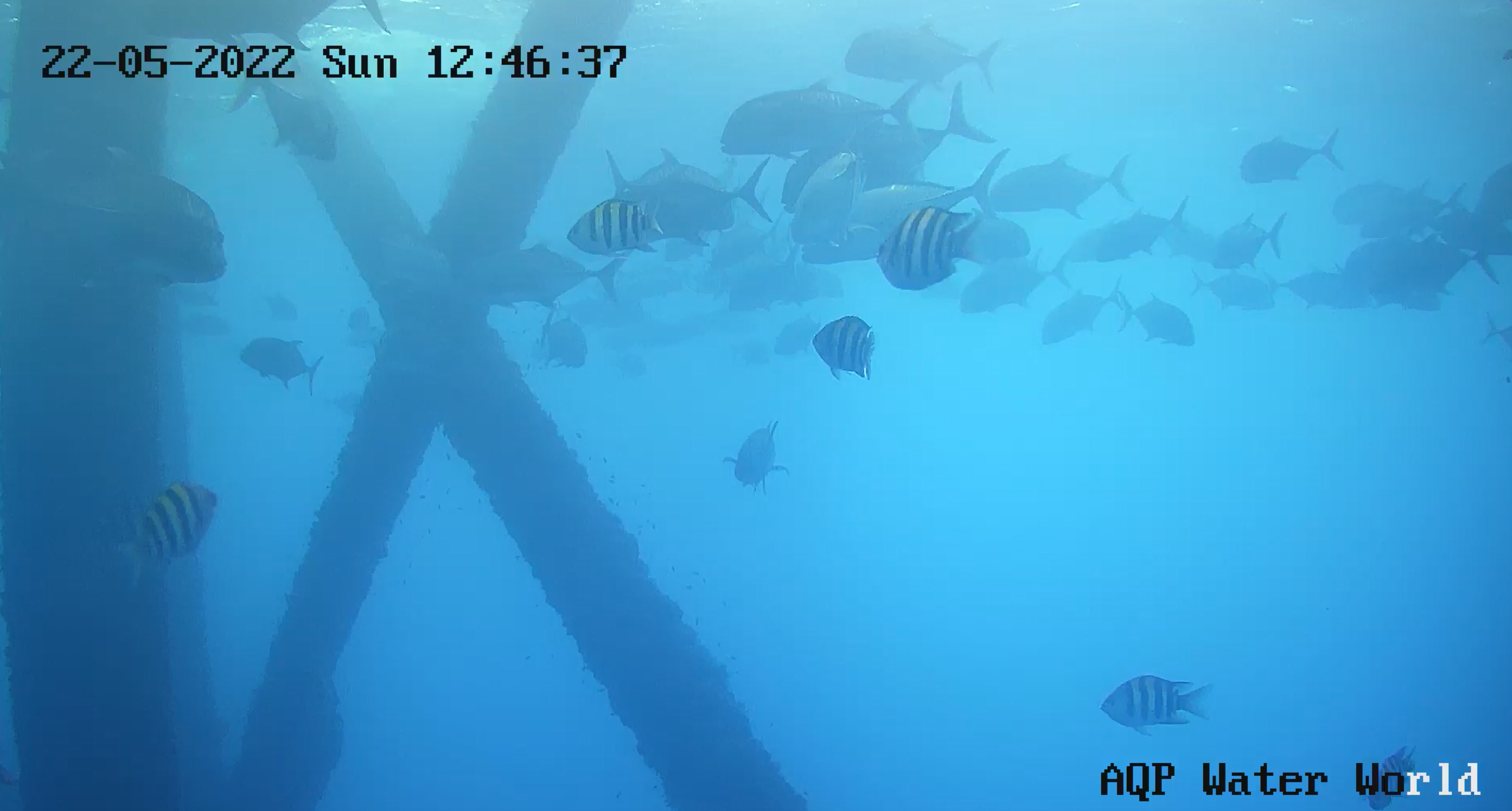
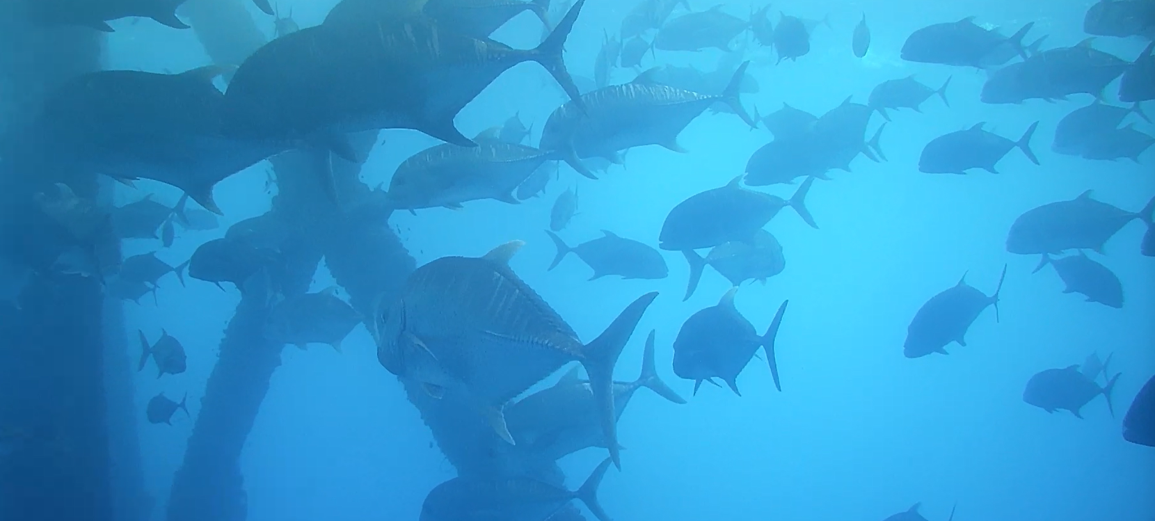
Application of underwater camera & AI software for aquatic animal identification under offshore petroleum platforms in the GoT
Conservation of iconic aquatic animals to increase their population and survival rate is vital in both Thailand and the global agenda. Considering the importance of this critical issue, PTTEP has launched a project of underwater camera installation and Artificial Intelligence (AI) software application for the identification of iconic aquatic animals from the recorded video files. Currently, there are underwater cameras installed on the jacket legs of two offshore petroleum platforms to monitor aquatic animals and to obtain the biodiversity baseline information. Besides, PTTEP plans to extend the use of this AI software in other marine areas through collaboration with other organizations.